Saturday, 23 November 2013

November 23 2013

          It's been nearly two weeks since my last blog post so I've sifted through plenty of photos to bring this one up to date.  It's nearly the end of November; I completed my Nav Canada air traffic control interview yesterday, two rides in the Cessna 182 recently and the occasional 172 ride.  I've kept busy with studying for my Commercial Pilots License and spending time in Winnipeg.  If the interview was a success, I'll have confirmation within a few weeks and I'll be put in a pool for training selection.  Each course only has three seats, so it's a very competitive selection process.  If I'm not selected, I'll likely pursue avionics in either Toronto or out on the west coast.

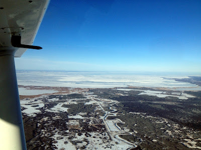
Earlier this afternoon, I did a flight with my dad over Lake Winnipeg from Grand Beach to Gimli.  It had been one of my goals for the longest time to climb up high over the lake and cruise to the opposite shoreline.  I'll include some of the shots in the following photo gallery.

 Following Highway 59 northbound, we met up with the intersection of the Brokenhead River, which unofficially marks the boundary of the Winnipeg Terminal Airspace.  That means that once we have crossed north of the river, we are able to ascend without attaining permission from a control tower.

In the air at 6000 feet above sea level, you can see the city of Winnipeg from above the lake.  It's pretty hard to make out buildings along the horizon in small photos but seeing it with your own eyes is pretty amazing.

 Another nice shot of the sun's reflection on the southern basin of Lake Winnipeg

It's too bad there was so much sun glare off our windscreen; this picture of a frozen Grand Beach would've turned out really nice.

 Glancing north towards Victoria Beach and Elk Island as we make our way across the lake

 Arriving over the town of Gimli, MB

 Gimli, Manitoba

The next photos were taken on a flight about 4 days ago when I was learning some tips from Tom Kresnyak on the Cessna 182.  We had some carburetor icing issues but fortunately landed safely on the runway back in St. Andrews after the flight.  

 Flyin high with my head in the clouds

 The end of the Red River where it pours into Lake Winnipeg

 Lockport, Manitoba, with the Red River & RR Floodway in the foreground

Many more to come.  Farewell until next time.

Tuesday, 12 November 2013

November 12 2013


          I've done several flights over the last few days with a variety of passengers.  I recently flew my brother, Devon, over Lake Winnipeg for some sightseeing before he departed to Toronto for some adventures. A few days later, a group of friends came flying over downtown Winnipeg. On the next flight, my passengers took a few property photos, and earlier today was another downtown adventure with a detour through Beausejour, up past Libau to join the Red River and finally southbound towards home.  The following are just a few of my favorites hand picked from the photos my friends have sent me.  I've left a couple higher quality pictures in for examples of the beauty of these full-sized photographs.
Lake Winnipeg beginning its freezing


Over the Red River floodway, looking west at the St. Andrews Airport

 Henderson Highway along the east side of the Red River looking north into Lockport, MB


Westbound along Highway 44, coming up on the 59 cloverleaf at 2000' Above Sea Level

 Garson Limestone Quarries


A wall of bad situations coming into St. Andrews

The Bridge to Nowhere over the Red River, looking north at the lower basins of Lake Winnipeg

 Selkirk Golf Course

 Larter's Golf Course in St. Andrews


I'll be flying the Cessna 182 hopefully at some point before the weekend, so that aircraft will allow me to travel further, faster, and encourage more variety of scenery.  I'm excited to go to new airports far from home and see what other areas of the country have to offer.

Wednesday, 6 November 2013

November 6 2013

Summer of Paint Lake Helitac

           Starting with the new flying outfit recently had me reflecting on all the extraordinary aircraft I've been able to work around over the last few years.  There's no way to fully appreciate just how awesome some of these airplanes are.  Over the last summer, I worked on the Paint Lake Helitac base, 25 minutes south of Thompson, MB.  Fighting fires alongside water bombers and helicopters made for many unforgettable experiences.  Hopefully this compilation of pictures can do some justice to pay proper tribute to the fire program for all the hard work that the Initial Attack Fire Rangers have to do.  I'll likely do a blog entry eventually for photos unrelated to the aircraft involved in fighting the fires.


 All the birds assembling on base at Paint Lake, Manitoba

Installing sprinkler setups in Ilford, Manitoba as part of a value protection team


 Fire retardant dropped from an aircraft creating a nonburnable barrier to protect the town


 The entire sky was on fire that day on Fire #65. Collectively, we were all successful in steering the damage around Ilford as it continued to creep towards Gillam.


 The forest fire grazed the edge of the town as we retreated to safety.  There's no stopping a 40,000 hectare fire with a few water hoses, so we moved to higher ground to let the water bombers give their best efforts.

 Thompson water bombers doing what they do best.

Our departure pick-up from a swamp.  The helicopters can't land amongst the trees, so if there are no swamps available in the vicinity of a fire, we often had to cut a landing pad for the loading of the helicopter. I suppose it's a blessing and a curse; northern Manitoba is mostly swamp and forest.

November 5 2013

Scenes from the Sky

          Looking back through all of my pictures today has me reflecting on lots of amazing memories of flying in the fall and winter time.  I've posted a handful of autumn and winter shots in previous posts, but for no particular reason, these photos didn't seem to make the stage.  Here are some equally fascinating photos of my favorite place to fly.

Downtown Winnipeg, shot to the Southwest over Point Douglas last winter


 Two great shots taken recently in Lockport, MB


These two photos were taken on the most recent Lac Du Bonnet flight.  It's a shame the windows weren't cleaner for the photo on the right; the dirt appears as haze on the lens.


A few shots of one of the flying machines that I recently retired from.

These last two photos inspired me to do a tribute to the aircraft that I've had a chance to work around over the recent summer in Paint Lake, MB.  Stay tuned for the next blog entry...

Sunday, 3 November 2013

November 3 2013

Sights around Southern Manitoba

          I mentioned a few days ago in my last blog entry that an important aspect of visual navigation by air is identifying familiar structures and the shape of the land.  This blog entry will have a few pictures taken around the southern part of Manitoba; see if you can identify them before scrolling to the bottom of the page, where I'll list where the photos were created.  I've been told by many of my passengers that their fear of heights doesn't give them anxiety in an aircraft; the world appears different and new when viewed from the sky, and maybe it's the detachment from the familiar that keeps people from experiencing the threat of falling to the ground below.  A flight instructor once told me that their fear of falling from high isn't experienced in an aircraft because in the case of an emergency, we're not bailing out the windows; we'll fly that plane right to the ground and land somewhere safe.

 2


3


4


5


6

7


8


9


Keep going to the bottom to find the info on each photo.

My flights have been sparse lately, as the main aircraft that I would tour with had been growing a list of problems.  It must have been over 6 weeks ago that the auxiliary plug for music input had been broken and jammed into the console of the aircraft. Not a big deal.  No more Frank Sinatra over the skies of downtown Winnipeg.
Not before long, the control for the flaps started sticking (imagine how a bird lands with its wings flared - that's basically what the flaps do.) That added some inconvenience to the situation, but we're still airworthy!
The transponder was the next thing to go.  Now, not only is Frank Sinatra cancelled, our flights over Winnipeg are no longer authorized, because a transponder is required to propagate our altitude to the Winnipeg air traffic controllers.
Still revenue-worthy, the flight club keeps the aircraft in service, without changing anything.
We are airborne again a few flights later when the landing light fails and now becomes intermittent.  Landings at night may or may not have a landing light to judge vertical depth to the runway.
Now things are getting a little ridiculous...

So instead I choose to do a flight in one of the two-seaters, a Cessna 152.  Looking at the logbooks, it hasn't been flown in about a week and the gas tanks are nearly empty.  Airplanes should be stored with full fuel to prevent moisture from condensing in the tanks. Water in the fuel is BAD.  I ask for half tanks so that I won't drag down the runway overweight, but the mechanic fills them right to the top anyway.
Continuing my walk around, I notice that the engine oil is extremely low.  Up until about 20 days before, a quart of oil had been added every second day, and none in the last series of flights.  Seems like the previous renters had been running the engine dry.  We topped up the oil and prepared for the taxi to the runway.  I noticed that the right brake had been soft, but there hadn't been any oil on the ground to indicate a leak.  Taxiing to the runway, everything is normal.  I inform the tower that we're ready for takeoff, and he replies that we are approved for a backtrack if required, left hand turn out, cleared for take-off Runway 31.  Brakes on, full throttle, RPM's are reading in the green power arc, upon releasing the brakes, we're rolling.  I notice immediately that we're heavy.  We are picking up significant speed though so we will get up to our climb speed at which we can safely rotate.  "Woo! We're airborne!" says my passenger as we begin our gradual climb out.  We turn crosswind to the south and then another left turn to fly parallel the runway towards Birds Hill Park.  The engine shudders for a moment. "Did you feel that?" I say to my passenger.  "Yeah what was that?"  It happens again, and the engine sounds like its not going to make it another 5 minutes across the forest ahead of us.  I call the tower and simply tell him that we're coming back for a full stop on runway 31 now.  He clears us for landing immediately and we bank the plane over and get back to the ground safely.  Taxiing the plane back to the apron (parking lot for airplanes) is all left turns, until the very last turn to the right.  Without any right-side braking power left, we blow right through our turn and nearly off the side of the pavement.  Doing a hard left-hand 360, I'm able to direct the airplane back to its parking spot and call it a day...and conclude flying with that flight outfit.  Later in the day, the president of the club explained that it was a magneto failure; where the aircraft could have safely continued flight on its back-up magneto.  Fortunately, there are alternate flight schools for back-up as well.


1. Highway #4's "Bridge to nowhere" in Breezy Point, MB
2. Cook's Creek in East Selkirk, MB
3. Gimli Harbor in... Gimli, MB
4. Birds Hill's Folk Fest 2012
5. Polo Park Shopping Center
6. Birds Hill's Man-made beaches
7. The Victoria Beach Pier
8. Stonewall, MB
9. Willow Island towards Gimli, MB
Friday, 1 November 2013

November 1 2013

Downtown Winnipeg

          There's a lot of action happening in a large city at any given instance, so every flight over Winnipeg, whether day or night, is exciting.  I have collected hundreds of pictures over Winnipeg, so this blog entry is going to be a tribute to the skies over Manitoba's capital.


Portage & Main, the city's most recognized intersection

To fly in the airspace over Winnipeg, we are required to schedule the flight at least one hour in advance, call the Winnipeg Tower over the radio upon entering city limits, and have a transponder equipped on the aircraft (a radar device that tells the air traffic controller how high we are flying.)


Cross-country flights in Manitoba's winter are more challenging to navigate visually, as some landscape features are masked by the white snow.  We use receivers on the aircraft to identify the direction of radio beacons, as to triangulate on maps approximately where we are.  It wouldn't be hard to find your way over the city though, as there's familiar structures to be seen everywhere.


My favorite time to fly in the city limits is during the final 10 minutes of sunset.  On the aviation weather website, Nav Canada, they provide a calculator to determine when the sun begins its descent behind the horizon, and when it is finally concluded.  This makes flight planning much easier to arrange, and provides the ideal lighting for some great shots of the skyline.


Most of our flights over downtown are done at 2000' above sea level, but in this shot we were asked by Winnipeg Tower to climb up to 2500' because the City of Winnipeg Police helicopter was doing their rounds about the city at 2000'.  That way, there is no risk of a conflict.  

Portage & Main, as seen from the North


Portage & Main, as seen from the South


Generally I prefer transiting into Winnipeg's downtown southbound over the Red River because we can follow it all the way from Selkirk if we so choose to do a Selkirk / Interlake tour prior to our urban ventures.  The official transit zone between the Winnipeg International airport and the St. Andrews airport is a corridor along highway #8, McPhillips.  Just like vehicles on the highway, air traffic heading into the city is to stay on the west side of McPhillips, and aircraft leaving the city, to the east ( ↓  Hwy #8  ↑ )


Manitoba's Legislative Building
May 2013

Portage & Main on the left side of the photo, this was shot over the Red River (bottom of the pic) while looking out the right window to a sunset in the west.  Notice the green light on the wing tip in the top left corner of the picture.  All airplanes will have a green light on the right, and a red light on the left. It helps with collision avoidance, so that you immediately know which direction your traffic is flying.

Until next time, Winnipeg.